
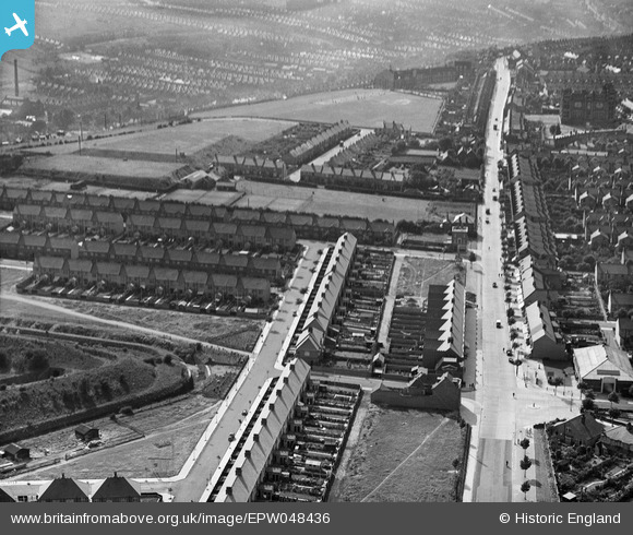
EPW048436 ENGLAND (1935). Watling Street, Osprey Avenue and environs, Gillingham, 1935
© Copyright OpenStreetMap contributors and licensed by the OpenStreetMap Foundation. 2026. Cartography is licensed as CC BY-SA.
Nearby Images (4)
EPW048436

EPW048438

EPW048437

EPW048439

Details
| Title | [EPW048436] Watling Street, Osprey Avenue and environs, Gillingham, 1935 |
| Reference | EPW048436 |
| Date | July-1935 |
| Link | |
| Place name | GILLINGHAM |
| Parish | |
| District | |
| Country | ENGLAND |
| Easting / Northing | 578036, 166778 |
| Longitude / Latitude | 0.55814161160105, 51.371609518888 |
| National Grid Reference | TQ780668 |
Pins
Be the first to add a comment to this image!