
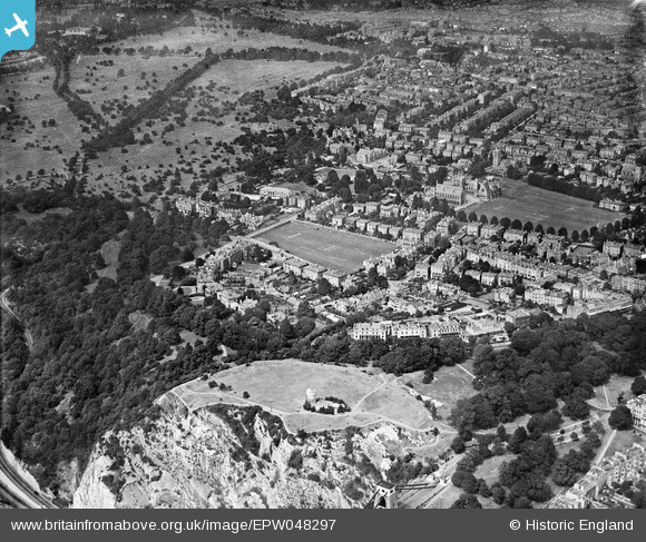
EPW048297 ENGLAND (1935). The Clifton Observatory, Observatory Hill and the surrounding residential area, Clifton, 1935
© Copyright OpenStreetMap contributors and licensed by the OpenStreetMap Foundation. 2026. Cartography is licensed as CC BY-SA.
Nearby Images (13)
EPW048297

EPW048296

EPW048293

EPW048294

EPW048290

EPW048291

EPW048300

EPW048298

EPW049533

EPW032530

EPW048292

EPW010231

EPW005467

Details
| Title | [EPW048297] The Clifton Observatory, Observatory Hill and the surrounding residential area, Clifton, 1935 |
| Reference | EPW048297 |
| Date | July-1935 |
| Link | |
| Place name | CLIFTON |
| Parish | |
| District | |
| Country | ENGLAND |
| Easting / Northing | 356748, 173676 |
| Longitude / Latitude | -2.6226298040199, 51.459917263725 |
| National Grid Reference | ST567737 |
Pins

Class31 |
Tuesday 1st of October 2013 09:17:44 AM |
