
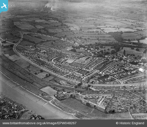
EPW048267 ENGLAND (1935). The residential area surrounding Portway and Springfield Avenue, Shirehampton, 1935
© Copyright OpenStreetMap contributors and licensed by the OpenStreetMap Foundation. 2025. Cartography is licensed as CC BY-SA.
Nearby Images (3)
EPW048267

EPW048264

EPW048266

Details
| Title | [EPW048267] The residential area surrounding Portway and Springfield Avenue, Shirehampton, 1935 |
| Reference | EPW048267 |
| Date | July-1935 |
| Link | |
| Place name | SHIREHAMPTON |
| Parish | |
| District | |
| Country | ENGLAND |
| Easting / Northing | 352787, 176870 |
| Longitude / Latitude | -2.6800727845315, 51.488320820278 |
| National Grid Reference | ST528769 |
Pins

Donal Lucey |
Tuesday 4th of March 2025 06:11:05 PM | |
|
Donal Lucey |
Tuesday 4th of March 2025 06:09:40 PM | |
|
Donal Lucey |
Tuesday 4th of March 2025 06:08:15 PM | |
|
Donal Lucey |
Tuesday 4th of March 2025 06:06:44 PM | |
|
Donal Lucey |
Tuesday 4th of March 2025 06:05:53 PM | |
|
Donal Lucey |
Tuesday 4th of March 2025 06:04:43 PM | |
|
Donal Lucey |
Tuesday 4th of March 2025 06:03:22 PM | |
|
Donal Lucey |
Tuesday 4th of March 2025 06:02:57 PM | |
|
Donal Lucey |
Tuesday 4th of March 2025 06:02:38 PM | |
|
Donal Lucey |
Tuesday 4th of March 2025 05:04:20 PM | |
|
Stoke Bishop Local History |
Sunday 1st of November 2015 08:33:11 PM | |
|
Stoke Bishop Local History |
Sunday 1st of November 2015 08:32:17 PM |