
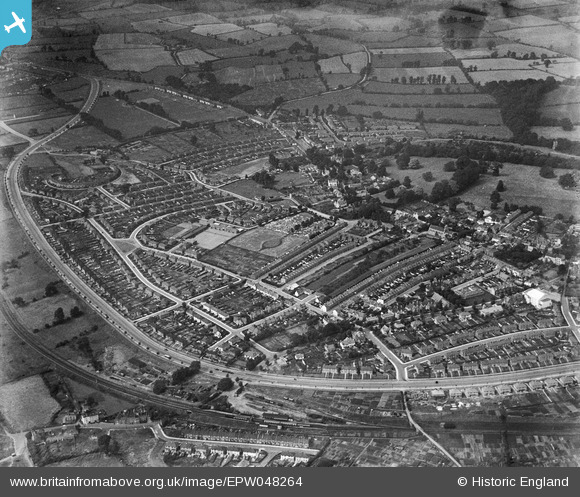
EPW048264 ENGLAND (1935). The residential area surrounding Portway and Springfield Avenue, Shirehampton, 1935
© Copyright OpenStreetMap contributors and licensed by the OpenStreetMap Foundation. 2025. Cartography is licensed as CC BY-SA.
Nearby Images (4)
EPW048264

EPW048267

EPW048266

EPW048265

Details
| Title | [EPW048264] The residential area surrounding Portway and Springfield Avenue, Shirehampton, 1935 |
| Reference | EPW048264 |
| Date | July-1935 |
| Link | |
| Place name | SHIREHAMPTON |
| Parish | |
| District | |
| Country | ENGLAND |
| Easting / Northing | 352876, 176883 |
| Longitude / Latitude | -2.6787926296968, 51.488445140955 |
| National Grid Reference | ST529769 |
