
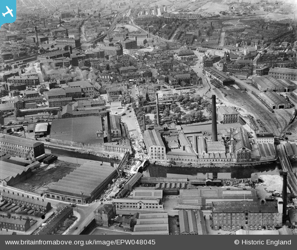
EPW048045 ENGLAND (1935). Mills on the River Calder, the Savile Bridge under construction and the town, Dewsbury, 1935
© Copyright OpenStreetMap contributors and licensed by the OpenStreetMap Foundation. 2026. Cartography is licensed as CC BY-SA.
Nearby Images (7)
EPW048045

EPW048046

EPW048047

EPW048048

EPW048044

EPW048049

EPW003255

Details
| Title | [EPW048045] Mills on the River Calder, the Savile Bridge under construction and the town, Dewsbury, 1935 |
| Reference | EPW048045 |
| Date | June-1935 |
| Link | |
| Place name | DEWSBURY |
| Parish | |
| District | |
| Country | ENGLAND |
| Easting / Northing | 424573, 421466 |
| Longitude / Latitude | -1.6278560016517, 53.688838690517 |
| National Grid Reference | SE246215 |
Pins

Savile Mills |
Tuesday 2nd of February 2021 04:06:18 PM | |
|
HOLMES |
Wednesday 3rd of June 2020 06:46:56 PM | |
|
HOLMES |
Wednesday 3rd of June 2020 06:43:36 PM | |
|
HOLMES |
Friday 17th of March 2017 11:23:21 AM | |
|
Philip |
Wednesday 19th of November 2014 07:25:45 PM | |
|
Ray Shill |
Saturday 30th of August 2014 02:38:14 PM |