
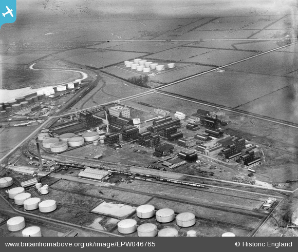
EPW046765 ENGLAND (1935). Salt End Distillery, Salt End, 1935
© Copyright OpenStreetMap contributors and licensed by the OpenStreetMap Foundation. 2026. Cartography is licensed as CC BY-SA.
Nearby Images (16)
EPW046765

EPW046768

EPW046763

EPW046766

EPW046769

EPW046762

EPW046764

EPW046767

EPW046770

EPW046760

EPW046761

EPW046759

EAW015666

EPW034671

EPW036520

EPW036519

Details
| Title | [EPW046765] Salt End Distillery, Salt End, 1935 |
| Reference | EPW046765 |
| Date | March-1935 |
| Link | |
| Place name | SALT END |
| Parish | PRESTON |
| District | |
| Country | ENGLAND |
| Easting / Northing | 516304, 427949 |
| Longitude / Latitude | -0.2366454305767, 53.734720134134 |
| National Grid Reference | TA163279 |
Pins
Be the first to add a comment to this image!