
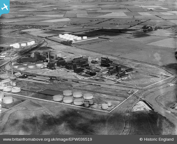
EPW036519 ENGLAND (1931). Salt End Distillery, Salt End, 1931
© Copyright OpenStreetMap contributors and licensed by the OpenStreetMap Foundation. 2026. Cartography is licensed as CC BY-SA.
Nearby Images (17)
EPW036519

EPW036520

EPW046759

EPW046761

EPW046760

EPW034672

EPW046770

EPW046764

EPW046769

EPW046766

EPW046763

EPW046768

EPW046765

EPW046762

EPW034639

EPW046767

EPW034641

Details
| Title | [EPW036519] Salt End Distillery, Salt End, 1931 |
| Reference | EPW036519 |
| Date | August-1931 |
| Link | |
| Place name | SALT END |
| Parish | PRESTON |
| District | |
| Country | ENGLAND |
| Easting / Northing | 516468, 427767 |
| Longitude / Latitude | -0.23422877965349, 53.733048291784 |
| National Grid Reference | TA165278 |
Pins
Be the first to add a comment to this image!