
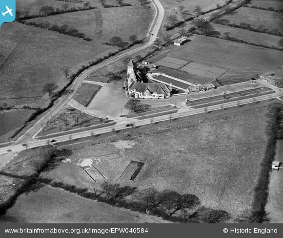
EPW046584 ENGLAND (1935). The Thatched Barn and the Barnet Bypass, Borehamwood, 1935
© Copyright OpenStreetMap contributors and licensed by the OpenStreetMap Foundation. 2026. Cartography is licensed as CC BY-SA.
Nearby Images (6)
EPW046584

EPW046583

EAW041408

EAW044445

EAW044447

EAW044446

Details
| Title | [EPW046584] The Thatched Barn and the Barnet Bypass, Borehamwood, 1935 |
| Reference | EPW046584 |
| Date | March-1935 |
| Link | |
| Place name | BOREHAMWOOD |
| Parish | ELSTREE AND BOREHAMWOOD |
| District | |
| Country | ENGLAND |
| Easting / Northing | 521182, 196729 |
| Longitude / Latitude | -0.2479716656756, 51.655803409467 |
| National Grid Reference | TQ212967 |
Pins

JanetP |
Saturday 22nd of March 2014 03:02:23 PM |