
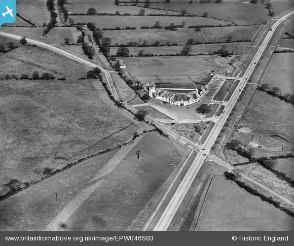
EPW046583 ENGLAND (1935). The Thatched Barn and the Barnet Bypass, Borehamwood, 1935
© Copyright OpenStreetMap contributors and licensed by the OpenStreetMap Foundation. 2026. Cartography is licensed as CC BY-SA.
Nearby Images (6)
EPW046583

EPW046584

EAW044445

EAW041408

EAW044447

EAW044446

Details
| Title | [EPW046583] The Thatched Barn and the Barnet Bypass, Borehamwood, 1935 |
| Reference | EPW046583 |
| Date | March-1935 |
| Link | |
| Place name | BOREHAMWOOD |
| Parish | ELSTREE AND BOREHAMWOOD |
| District | |
| Country | ENGLAND |
| Easting / Northing | 521108, 196702 |
| Longitude / Latitude | -0.24905036083614, 51.655576683174 |
| National Grid Reference | TQ211967 |
Pins

Merlin1993 |
Friday 1st of August 2014 10:58:52 AM | |
|
Merlin1993 |
Friday 1st of August 2014 10:57:53 AM |