
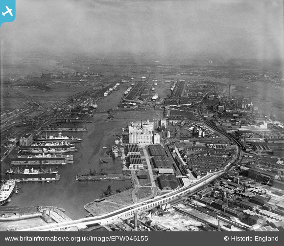
EPW046155 ENGLAND (1934). The Royal Victoria, Royal Albert, King George V Docks and environs, Silvertown, from the west, 1934
© Copyright OpenStreetMap contributors and licensed by the OpenStreetMap Foundation. 2026. Cartography is licensed as CC BY-SA.
Nearby Images (16)
EPW046155

EAW008817

EPW044114

EAW008824

EAW008823

EPW008886

EAW009065

EAW008818

EAW000038

EAW000053

EAW008820

EAW008826

EAW009064

EPW008889

EAW008819

EPW006146

Details
| Title | [EPW046155] The Royal Victoria, Royal Albert, King George V Docks and environs, Silvertown, from the west, 1934 |
| Reference | EPW046155 |
| Date | September-1934 |
| Link | |
| Place name | SILVERTOWN |
| Parish | |
| District | |
| Country | ENGLAND |
| Easting / Northing | 540262, 180416 |
| Longitude / Latitude | 0.021194094152333, 51.504764658588 |
| National Grid Reference | TQ403804 |
Pins

John W |
Saturday 4th of February 2017 06:31:14 PM | |

Class31 |
Saturday 28th of February 2015 07:40:34 PM | |
|
Ian |
Thursday 1st of August 2013 10:22:54 AM | |
|
Ian |
Thursday 1st of August 2013 10:22:22 AM |