
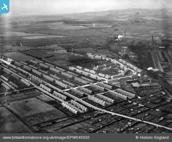
EPW045932 ENGLAND (1934). Deneside, Seaham, from the east, 1934
© Copyright OpenStreetMap contributors and licensed by the OpenStreetMap Foundation. 2026. Cartography is licensed as CC BY-SA.
Nearby Images (2)
EPW045932

EPW026655

Details
| Title | [EPW045932] Deneside, Seaham, from the east, 1934 |
| Reference | EPW045932 |
| Date | August-1934 |
| Link | |
| Place name | SEAHAM |
| Parish | SEAHAM |
| District | |
| Country | ENGLAND |
| Easting / Northing | 441855, 549325 |
| Longitude / Latitude | -1.3482668655328, 54.83690471067 |
| National Grid Reference | NZ419493 |
Pins

Porcy |
Thursday 25th of April 2019 11:42:15 PM |
User Comment Contributions
quality street |
ian |
Tuesday 13th of October 2015 09:17:18 PM |