
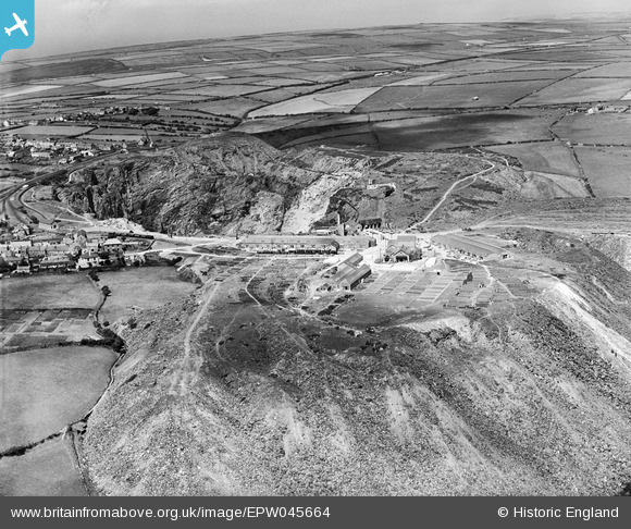
EPW045664 ENGLAND (1934). The Old Delabole Slate Quarry, Delabole, 1934
© Copyright OpenStreetMap contributors and licensed by the OpenStreetMap Foundation. 2026. Cartography is licensed as CC BY-SA.
Nearby Images (7)
EPW045664

EPW045662

EPW045663

EPW045661

EPW045665

EPW045667

EPW045669

Details
| Title | [EPW045664] The Old Delabole Slate Quarry, Delabole, 1934 |
| Reference | EPW045664 |
| Date | July-1934 |
| Link | |
| Place name | DELABOLE |
| Parish | ST. TEATH |
| District | |
| Country | ENGLAND |
| Easting / Northing | 207461, 83585 |
| Longitude / Latitude | -4.7221717075234, 50.619557530507 |
| National Grid Reference | SX075836 |
Pins
Be the first to add a comment to this image!