
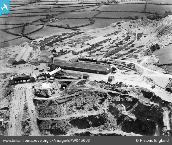
EPW045663 ENGLAND (1934). The Old Delabole Slate Quarry, Delabole, 1934
© Copyright OpenStreetMap contributors and licensed by the OpenStreetMap Foundation. 2026. Cartography is licensed as CC BY-SA.
Nearby Images (6)
EPW045663

EPW045664

EPW045662

EPW045661

EPW045665

EPW045669

Details
| Title | [EPW045663] The Old Delabole Slate Quarry, Delabole, 1934 |
| Reference | EPW045663 |
| Date | July-1934 |
| Link | |
| Place name | DELABOLE |
| Parish | ST. TEATH |
| District | |
| Country | ENGLAND |
| Easting / Northing | 207445, 83613 |
| Longitude / Latitude | -4.7224121806496, 50.619803791357 |
| National Grid Reference | SX074836 |
Pins

MB |
Wednesday 1st of January 2014 09:02:16 PM |