
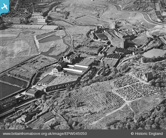
EPW045050 ENGLAND (1934). The Small and Parkes Hendham Vale Engine Packing Works, the Manchester General Cemetery and the Harpurhey Dye and Print Works, Manchester, 1934
© Copyright OpenStreetMap contributors and licensed by the OpenStreetMap Foundation. 2026. Cartography is licensed as CC BY-SA.
Nearby Images (41)
EPW045050

EPW060515

EPW060511

EPW054333

EPW060513

EPW060516

EPW045049

EPW060514

EAW042045

EPW054330

EPW054328

EPW045052

EPW045048

EPW054326

EAW042046

EPW054331

EPW060512

EPW054327

EPW045051

EPW054329

EPW054332

EPW060517

EPW045053

EAW041327

EAW042040

EAW042041

EAW042038

EAW042035

EAW042036

EAW042044

EAW042047

EAW042042

EAW042032

EAW042039

EAW042043

EAW041324

EAW042037

EAW042033

EAW042034

EAW041326

EAW041325

Details
| Title | [EPW045050] The Small and Parkes Hendham Vale Engine Packing Works, the Manchester General Cemetery and the Harpurhey Dye and Print Works, Manchester, 1934 |
| Reference | EPW045050 |
| Date | June-1934 |
| Link | |
| Place name | MANCHESTER |
| Parish | |
| District | |
| Country | ENGLAND |
| Easting / Northing | 385338, 401241 |
| Longitude / Latitude | -2.2210979075275, 53.507403445294 |
| National Grid Reference | SD853012 |
Pins

boltie |
Sunday 15th of December 2013 08:58:26 AM |