
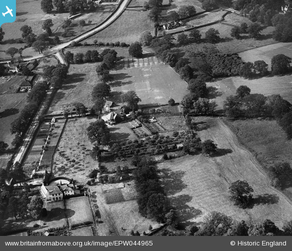
EPW044965 ENGLAND (1934). Brockdale and environs, Winkfield Row, 1934
© Copyright OpenStreetMap contributors and licensed by the OpenStreetMap Foundation. 2026. Cartography is licensed as CC BY-SA.
Nearby Images (14)
EPW044965

 0°
0m
0°
0m
EPW044952
 56°
23m
56°
23m
EPW044954
 76°
100m
76°
100m
EPW044961
 5°
107m
5°
107m
EPW044964
 41°
120m
41°
120m
EPW044953
 37°
127m
37°
127m
EPW044955
 56°
141m
56°
141m
EPW044962
 9°
165m
9°
165m
EPW044960
 24°
166m
24°
166m
EPW044957
 82°
199m
82°
199m
EPW044959
 91°
210m
91°
210m
EPW044963
 9°
221m
9°
221m
EPW044956
 86°
228m
86°
228m
EPW044958
 91°
230m
91°
230m
Details
| Title | [EPW044965] Brockdale and environs, Winkfield Row, 1934 |
| Reference | EPW044965 |
| Date | June-1934 |
| Link | |
| Place name | WINKFIELD ROW |
| Parish | WARFIELD |
| District | |
| Country | ENGLAND |
| Easting / Northing | 489252, 171402 |
| Longitude / Latitude | -0.71588829427577, 51.434088281251 |
| National Grid Reference | SU893714 |
Pins
Be the first to add a comment to this image!