
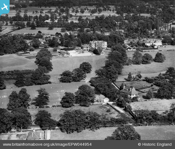
EPW044954 ENGLAND (1934). Lambrook School and grounds, Winkfield Row, 1934
© Copyright OpenStreetMap contributors and licensed by the OpenStreetMap Foundation. 2026. Cartography is licensed as CC BY-SA.
Nearby Images (14)
EPW044954

 0°
0m
0°
0m
EPW044955
 19°
58m
19°
58m
EPW044964
 344°
69m
344°
69m
EPW044952
 262°
79m
262°
79m
EPW044953
 344°
81m
344°
81m
EPW044957
 88°
100m
88°
100m
EPW044965
 256°
100m
256°
100m
EPW044959
 104°
115m
104°
115m
EPW044961
 313°
121m
313°
121m
EPW044956
 93°
130m
93°
130m
EPW044960
 347°
131m
347°
131m
EPW044958
 102°
134m
102°
134m
EPW044962
 333°
156m
333°
156m
EPW044963
 342°
204m
342°
204m
Details
| Title | [EPW044954] Lambrook School and grounds, Winkfield Row, 1934 |
| Reference | EPW044954 |
| Date | June-1934 |
| Link | |
| Place name | WINKFIELD ROW |
| Parish | WINKFIELD |
| District | |
| Country | ENGLAND |
| Easting / Northing | 489350, 171426 |
| Longitude / Latitude | -0.7144726451203, 51.434288599048 |
| National Grid Reference | SU894714 |
Pins
Be the first to add a comment to this image!