
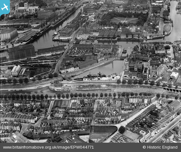
EPW044771 ENGLAND (1934). The River Avon, Bathurst Basin, Queen Square and environs, Bristol, 1934
© Copyright OpenStreetMap contributors and licensed by the OpenStreetMap Foundation. 2026. Cartography is licensed as CC BY-SA.
Nearby Images (17)
EPW044771

EPW044769

EPW044768

EPW044772

EPW044770

EPW044773

EPW044774

EAW586137

EPW005436

EPW005437

EPW005434

EPW005438

EPW005433

EPW005435

EAW033320

EAW209373

EAW002047

Details
| Title | [EPW044771] The River Avon, Bathurst Basin, Queen Square and environs, Bristol, 1934 |
| Reference | EPW044771 |
| Date | June-1934 |
| Link | |
| Place name | BRISTOL |
| Parish | |
| District | |
| Country | ENGLAND |
| Easting / Northing | 358722, 172151 |
| Longitude / Latitude | -2.5940369610765, 51.446351756439 |
| National Grid Reference | ST587722 |
Pins


User Comment Contributions

Bathurst Basin 20/2/2014 |

Class31 |
Wednesday 26th of February 2014 02:42:45 PM |