
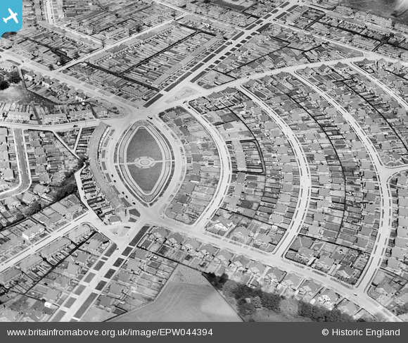
EPW044394 ENGLAND (1934). The Oval and the Marlborough Park Estate, Sidcup, 1934
© Copyright OpenStreetMap contributors and licensed by the OpenStreetMap Foundation. 2026. Cartography is licensed as CC BY-SA.
Nearby Images (8)
EPW044394

EPW044397

EPW038431

EPW038436

EPW044395

EPW038434

EPW038433

EPW038435

Details
| Title | [EPW044394] The Oval and the Marlborough Park Estate, Sidcup, 1934 |
| Reference | EPW044394 |
| Date | May-1934 |
| Link | |
| Place name | SIDCUP |
| Parish | |
| District | |
| Country | ENGLAND |
| Easting / Northing | 546296, 173818 |
| Longitude / Latitude | 0.10535049716084, 51.443942006325 |
| National Grid Reference | TQ463738 |
Pins

Barney |
Sunday 20th of May 2018 11:43:21 AM | |

Tom Burnham |
Thursday 3rd of October 2013 07:39:40 PM | |
|
Tom Burnham |
Thursday 3rd of October 2013 07:39:09 PM | |
|
Tom Burnham |
Thursday 3rd of October 2013 07:38:30 PM | |
|
Tom Burnham |
Thursday 3rd of October 2013 07:37:38 PM | |
|
Tom Burnham |
Thursday 3rd of October 2013 07:37:01 PM |