
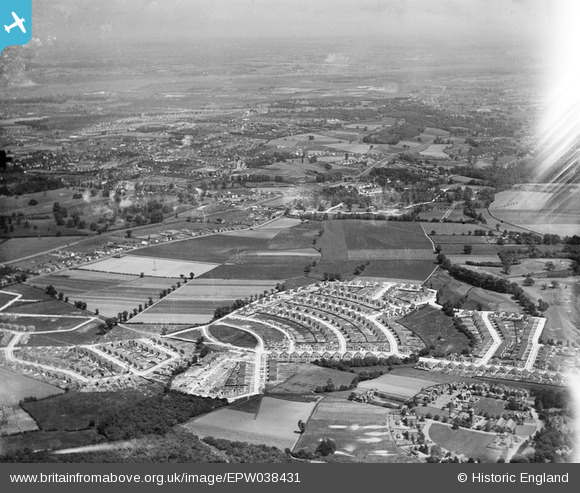
EPW038431 ENGLAND (1932). New housing site near Blackfen, Bexley, from the west, 1932
© Copyright OpenStreetMap contributors and licensed by the OpenStreetMap Foundation. 2026. Cartography is licensed as CC BY-SA.
Nearby Images (8)
EPW038431

EPW044397

EPW044394

EPW044395

EPW038434

EPW038436

EPW038433

EPW038257

Details
| Title | [EPW038431] New housing site near Blackfen, Bexley, from the west, 1932 |
| Reference | EPW038431 |
| Date | 14-June-1932 |
| Link | |
| Place name | BEXLEY |
| Parish | |
| District | |
| Country | ENGLAND |
| Easting / Northing | 546284, 173755 |
| Longitude / Latitude | 0.10515188782459, 51.443378955653 |
| National Grid Reference | TQ463738 |
