
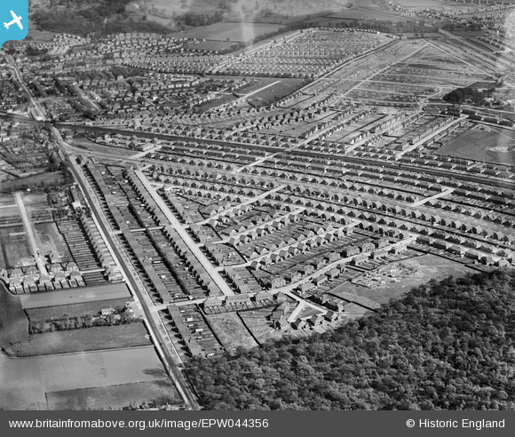
EPW044356 ENGLAND (1934). The Falconwood Park Estate and the Bexleyheath Line, Falconwood, 1934
© Copyright OpenStreetMap contributors and licensed by the OpenStreetMap Foundation. 2026. Cartography is licensed as CC BY-SA.
Nearby Images (5)
EPW044356

EPW038426

EPW044278

EPW038424

EPW044276

Details
| Title | [EPW044356] The Falconwood Park Estate and the Bexleyheath Line, Falconwood, 1934 |
| Reference | EPW044356 |
| Date | May-1934 |
| Link | |
| Place name | FALCONWOOD |
| Parish | |
| District | |
| Country | ENGLAND |
| Easting / Northing | 545159, 175908 |
| Longitude / Latitude | 0.089857421194761, 51.463016582177 |
| National Grid Reference | TQ452759 |
Pins

Steve |
Wednesday 7th of August 2019 01:11:07 AM | |
|
Kippy |
Friday 19th of February 2016 06:35:08 PM | |
|
SirTricky |
Friday 25th of July 2014 10:17:37 AM | |
|
SirTricky |
Friday 25th of July 2014 10:10:34 AM | |
|
SirTricky |
Friday 25th of July 2014 10:06:50 AM | |
|
Gaynor |
Thursday 24th of July 2014 09:54:11 PM | |
|
Gaynor |
Thursday 24th of July 2014 09:52:23 PM | |
|
Gaynor |
Thursday 24th of July 2014 09:51:26 PM | |
|
Gaynor |
Thursday 24th of July 2014 09:49:41 PM | |
|
Gaynor |
Thursday 24th of July 2014 09:49:05 PM | |
|
Gaynor |
Thursday 24th of July 2014 09:48:18 PM | |
|
Gaynor |
Thursday 24th of July 2014 09:46:47 PM | |
|
Gaynor |
Thursday 24th of July 2014 09:44:55 PM |