
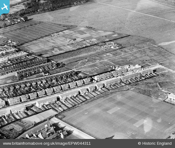
EPW044311 ENGLAND (1934). Construction of new housing at Woodlands Road, Lower Edmonton, 1934
© Copyright OpenStreetMap contributors and licensed by the OpenStreetMap Foundation. 2025. Cartography is licensed as CC BY-SA.
Nearby Images (10)
EPW044311

EPW044727

EPW044310

EPW044313

EPW044312

EPW044729

EPW044728

EPW044725

EPW044730

EPW044717

Details
| Title | [EPW044311] Construction of new housing at Woodlands Road, Lower Edmonton, 1934 |
| Reference | EPW044311 |
| Date | May-1934 |
| Link | |
| Place name | LOWER EDMONTON |
| Parish | |
| District | |
| Country | ENGLAND |
| Easting / Northing | 535253, 194324 |
| Longitude / Latitude | -0.045586358097717, 51.630979558041 |
| National Grid Reference | TQ353943 |
Pins

john ruscoe |
Saturday 2nd of November 2013 04:31:44 AM | |
|
john ruscoe |
Saturday 2nd of November 2013 04:30:58 AM | |
|
john ruscoe |
Saturday 2nd of November 2013 04:30:22 AM |