
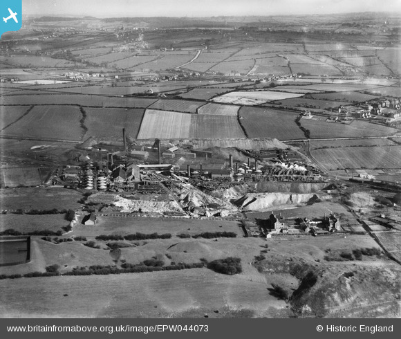
EPW044073 ENGLAND (1934). The Pye Hill Colliery and surrounding countryside, Jacksdale, from the north-west, 1934
© Copyright OpenStreetMap contributors and licensed by the OpenStreetMap Foundation. 2026. Cartography is licensed as CC BY-SA.
Nearby Images (4)
EPW044073

EAW002804

EAW002802

EPW044072

Details
| Title | [EPW044073] The Pye Hill Colliery and surrounding countryside, Jacksdale, from the north-west, 1934 |
| Reference | EPW044073 |
| Date | April-1934 |
| Link | |
| Place name | JACKSDALE |
| Parish | SELSTON |
| District | |
| Country | ENGLAND |
| Easting / Northing | 444389, 352427 |
| Longitude / Latitude | -1.3374743317655, 53.066936407977 |
| National Grid Reference | SK444524 |
Pins

Rob |
Saturday 26th of December 2015 09:05:43 PM |