
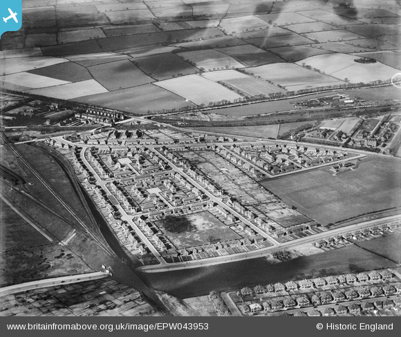
EPW043953 ENGLAND (1934). Housing at Desford Close, Ventnor Rise and Harmston Rise, Old Basford, 1934
© Copyright OpenStreetMap contributors and licensed by the OpenStreetMap Foundation. 2026. Cartography is licensed as CC BY-SA.
Nearby Images (8)
EPW043953

EPW043951

EPW043954

EPW043955

EPW043952

EPW043606

EPW043604

EPW043605

Details
| Title | [EPW043953] Housing at Desford Close, Ventnor Rise and Harmston Rise, Old Basford, 1934 |
| Reference | EPW043953 |
| Date | April-1934 |
| Link | |
| Place name | OLD BASFORD |
| Parish | |
| District | |
| Country | ENGLAND |
| Easting / Northing | 455974, 343809 |
| Longitude / Latitude | -1.1660766295507, 52.988379067742 |
| National Grid Reference | SK560438 |
Pins

KC |
Thursday 27th of July 2023 10:29:28 AM |