
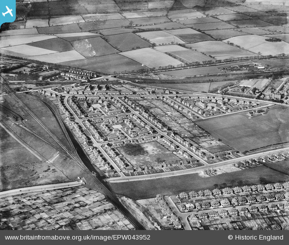
EPW043952 ENGLAND (1934). Housing at Desford Close, Ventnor Rise and Harmston Rise, Old Basford, 1934
© Copyright OpenStreetMap contributors and licensed by the OpenStreetMap Foundation. 2026. Cartography is licensed as CC BY-SA.
Nearby Images (8)
EPW043952

EPW043955

EPW043954

EPW043604

EPW043951

EPW043953

EPW043606

EPW043605

Details
| Title | [EPW043952] Housing at Desford Close, Ventnor Rise and Harmston Rise, Old Basford, 1934 |
| Reference | EPW043952 |
| Date | April-1934 |
| Link | |
| Place name | OLD BASFORD |
| Parish | |
| District | |
| Country | ENGLAND |
| Easting / Northing | 455950, 343738 |
| Longitude / Latitude | -1.1664464376315, 52.987743335655 |
| National Grid Reference | SK560437 |
Pins

Matt Wilson |
Wednesday 5th of August 2015 10:11:18 PM | |
|
Matt Wilson |
Wednesday 5th of August 2015 10:10:42 PM | |
|
Matt Wilson |
Wednesday 5th of August 2015 09:55:12 PM | |
|
Matt Wilson |
Wednesday 5th of August 2015 09:44:50 PM | |
|
Matt Wilson |
Wednesday 5th of August 2015 09:42:50 PM | |
|
Matt Wilson |
Wednesday 5th of August 2015 09:41:09 PM | |
|
Matt Wilson |
Wednesday 5th of August 2015 09:37:34 PM | |
|
Matt Wilson |
Wednesday 5th of August 2015 09:27:02 PM | |
|
Matt Wilson |
Wednesday 5th of August 2015 09:23:55 PM | |
|
Matt Wilson |
Wednesday 5th of August 2015 09:23:17 PM | |
|
Matt Wilson |
Wednesday 5th of August 2015 09:22:42 PM | |
|
Matt Wilson |
Wednesday 5th of August 2015 09:22:01 PM | |
|
Matt Wilson |
Wednesday 5th of August 2015 09:20:03 PM |