
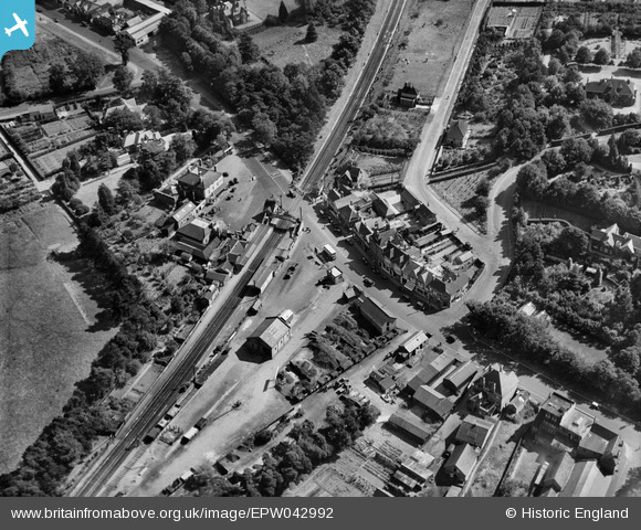
EPW042992 ENGLAND (1933). Sunningdale and Windlesham railway station and environs, Broomhall, 1933
© Copyright OpenStreetMap contributors and licensed by the OpenStreetMap Foundation. 2025. Cartography is licensed as CC BY-SA.
Nearby Images (3)
EPW042992

EPW036158

EPW036155

Details
| Title | [EPW042992] Sunningdale and Windlesham railway station and environs, Broomhall, 1933 |
| Reference | EPW042992 |
| Date | September-1933 |
| Link | |
| Place name | BROOMHALL |
| Parish | SUNNINGDALE |
| District | |
| Country | ENGLAND |
| Easting / Northing | 495245, 166737 |
| Longitude / Latitude | -0.63094317901827, 51.391173598842 |
| National Grid Reference | SU952667 |
Pins
Be the first to add a comment to this image!