
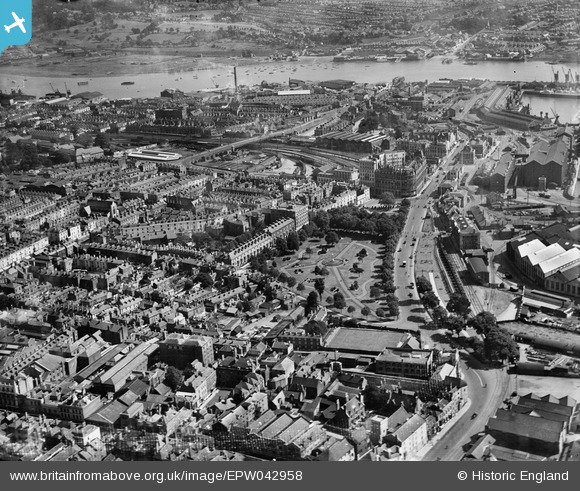
EPW042958 ENGLAND (1933). Queen's Park, the Town and Dock Railway Station and environs, Southampton, 1933
© Copyright OpenStreetMap contributors and licensed by the OpenStreetMap Foundation. 2026. Cartography is licensed as CC BY-SA.
Nearby Images (6)
EPW042958

EPW009077

EPW001504

EPW041064

EAW008801

EPW039727

Details
| Title | [EPW042958] Queen's Park, the Town and Dock Railway Station and environs, Southampton, 1933 |
| Reference | EPW042958 |
| Date | August-1933 |
| Link | |
| Place name | SOUTHAMPTON |
| Parish | |
| District | |
| Country | ENGLAND |
| Easting / Northing | 442334, 111096 |
| Longitude / Latitude | -1.3979591071292, 50.897236123557 |
| National Grid Reference | SU423111 |
Pins

cabbagecaff |
Sunday 21st of July 2024 06:41:09 PM | |
|
jkm |
Friday 21st of January 2022 01:10:15 PM | |
|
jkm |
Friday 21st of January 2022 01:04:08 PM | |
|
jkm |
Friday 21st of January 2022 01:03:38 PM | |
|
jkm |
Friday 21st of January 2022 01:02:11 PM | |
|
jkm |
Friday 21st of January 2022 01:00:56 PM | |
 |

Class31 |
Thursday 29th of May 2014 07:54:07 PM |
|
Class31 |
Thursday 29th of May 2014 07:52:45 PM | |
 |
Class31 |
Monday 5th of August 2013 10:55:05 PM |
 |
Class31 |
Monday 5th of August 2013 10:41:41 PM |
 |
Class31 |
Monday 5th of August 2013 10:38:51 PM |
|
Class31 |
Monday 5th of August 2013 10:25:33 PM |

