
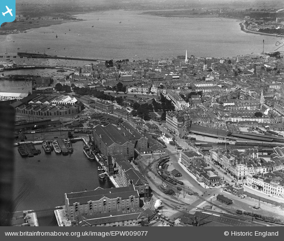
EPW009077 ENGLAND (1923). The Inner Dock and Queen's Park area, Southampton, 1923
© Copyright OpenStreetMap contributors and licensed by the OpenStreetMap Foundation. 2026. Cartography is licensed as CC BY-SA.
Nearby Images (11)
EPW009077

EPW042958

EPW001504

EAW008801

EAW008800

EAW008798

EAW008791

EPW041064

EAW008795

EAW001347

EAW008796

Details
| Title | [EPW009077] The Inner Dock and Queen's Park area, Southampton, 1923 |
| Reference | EPW009077 |
| Date | 1923 |
| Link | |
| Place name | SOUTHAMPTON |
| Parish | |
| District | |
| Country | ENGLAND |
| Easting / Northing | 442389, 110998 |
| Longitude / Latitude | -1.3971883649451, 50.896350779793 |
| National Grid Reference | SU424110 |
Pins

Andy Russel |
Monday 1st of May 2023 11:35:25 PM | |
|
Andy Russel |
Monday 1st of May 2023 11:34:03 PM | |
|
Andy Russel |
Monday 1st of May 2023 11:32:55 PM | |
|
Andy Russel |
Monday 1st of May 2023 11:30:53 PM | |
|
Andy Russel |
Monday 1st of May 2023 11:28:22 PM | |
|
chainbull |
Friday 1st of August 2014 08:34:23 PM | |
|
chainbull |
Friday 1st of August 2014 08:32:17 PM | |

Class31 |
Friday 30th of May 2014 09:16:08 PM | |
 |
Class31 |
Friday 30th of May 2014 09:15:03 PM |
|
Class31 |
Friday 30th of May 2014 09:14:04 PM |

