
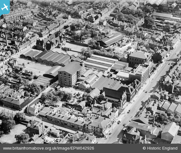
EPW042926 ENGLAND (1933). Kenrick and Jefferson Printing Works, the High Street and environs, West Bromwich, 1933
© Copyright OpenStreetMap contributors and licensed by the OpenStreetMap Foundation. 2026. Cartography is licensed as CC BY-SA.
Nearby Images (14)
EPW042926

EPW042921

EPW042922

EPW042930

EPW042928

EPW042924

EPW042925

EPW042929

EPW042923

EPW042927

EPR000565

EPW021862

EPW057564

EPW057563

Details
| Title | [EPW042926] Kenrick and Jefferson Printing Works, the High Street and environs, West Bromwich, 1933 |
| Reference | EPW042926 |
| Date | August-1933 |
| Link | |
| Place name | WEST BROMWICH |
| Parish | |
| District | |
| Country | ENGLAND |
| Easting / Northing | 400453, 291362 |
| Longitude / Latitude | -1.9933231222233, 52.519773808883 |
| National Grid Reference | SP005914 |
Pins

DaveT |
Friday 23rd of January 2015 11:10:17 PM | |
|
DaveT |
Sunday 20th of October 2013 04:11:57 PM |