
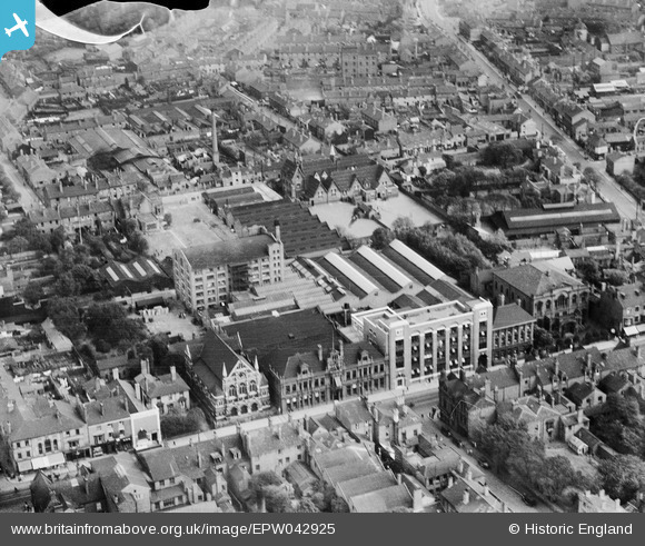
EPW042925 ENGLAND (1933). Kenrick and Jefferson Printing Works and environs, West Bromwich, 1933
© Copyright OpenStreetMap contributors and licensed by the OpenStreetMap Foundation. 2026. Cartography is licensed as CC BY-SA.
Nearby Images (15)
EPW042925

EPW042923

EPW042930

EPW042922

EPW042924

EPW042926

EPW042927

EPW042921

EPW042928

EPW042929

EPR000565

EPW021862

EPW057564

EPW057563

EPW053756

Details
| Title | [EPW042925] Kenrick and Jefferson Printing Works and environs, West Bromwich, 1933 |
| Reference | EPW042925 |
| Date | August-1933 |
| Link | |
| Place name | WEST BROMWICH |
| Parish | |
| District | |
| Country | ENGLAND |
| Easting / Northing | 400478, 291346 |
| Longitude / Latitude | -1.9929546641248, 52.51962993237 |
| National Grid Reference | SP005913 |
Pins

Rob |
Friday 26th of August 2022 01:17:15 PM |