
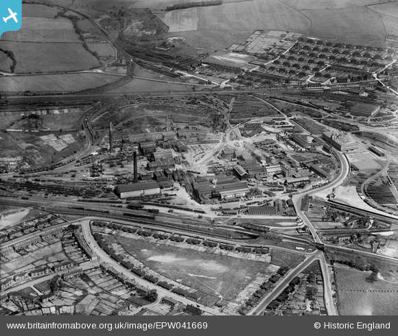
EPW041669 ENGLAND (1933). The Staveley Iron Works, Staveley, 1933
© Copyright OpenStreetMap contributors and licensed by the OpenStreetMap Foundation. 2026. Cartography is licensed as CC BY-SA.
Nearby Images (15)
EPW041669

EPW041666

EAW003072

EPW057352

EPW041671

EPW041667

EAW044348

EPW041665

EPW041668

EPW057341

EPW041672

EAW003057

EPW041670

EAW003058

EPW057337

Details
| Title | [EPW041669] The Staveley Iron Works, Staveley, 1933 |
| Reference | EPW041669 |
| Date | June-1933 |
| Link | |
| Place name | STAVELEY |
| Parish | STAVELEY |
| District | |
| Country | ENGLAND |
| Easting / Northing | 441406, 374890 |
| Longitude / Latitude | -1.3790859623489, 53.269105672211 |
| National Grid Reference | SK414749 |
Pins
Be the first to add a comment to this image!
User Comment Contributions
Hollingwood Lock,Chesterfield Canal |

Dr AP Newman |
Sunday 10th of January 2016 01:41:42 PM |