
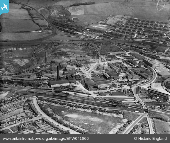
EPW041666 ENGLAND (1933). The Staveley Iron Works, Staveley, 1933
© Copyright OpenStreetMap contributors and licensed by the OpenStreetMap Foundation. 2026. Cartography is licensed as CC BY-SA.
Nearby Images (14)
EPW041666

EPW041669

EAW003072

EPW057352

EAW044348

EPW041665

EPW041671

EPW041668

EPW041667

EPW057341

EAW003057

EPW041672

EPW041670

EAW003058

Details
| Title | [EPW041666] The Staveley Iron Works, Staveley, 1933 |
| Reference | EPW041666 |
| Date | June-1933 |
| Link | |
| Place name | STAVELEY |
| Parish | STAVELEY |
| District | |
| Country | ENGLAND |
| Easting / Northing | 441392, 374915 |
| Longitude / Latitude | -1.3792926344347, 53.26933149717 |
| National Grid Reference | SK414749 |
Pins
Be the first to add a comment to this image!