
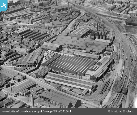
EPW041541 ENGLAND (1933). The Staybrite Steel Works, Tinsley, 1933
© Copyright OpenStreetMap contributors and licensed by the OpenStreetMap Foundation. 2026. Cartography is licensed as CC BY-SA.
Nearby Images (25)
EPW041541

EAW020052

EAW020050

EPW041545

EAW020051

EAW020045

EPW041543

EAW020042

EAW018763

EPW041540

EAW020047

EAW020043

EAW018761

EPW041542

EPW041544

EAW018762

EAW020044

EAW018759

EAW020048

EAW018760

EAW020049

EAW018798

EAW018799

EPW061486

EPW061482

Details
| Title | [EPW041541] The Staybrite Steel Works, Tinsley, 1933 |
| Reference | EPW041541 |
| Date | June-1933 |
| Link | |
| Place name | TINSLEY |
| Parish | |
| District | |
| Country | ENGLAND |
| Easting / Northing | 439141, 390417 |
| Longitude / Latitude | -1.4111296968286, 53.408853470179 |
| National Grid Reference | SK391904 |
