
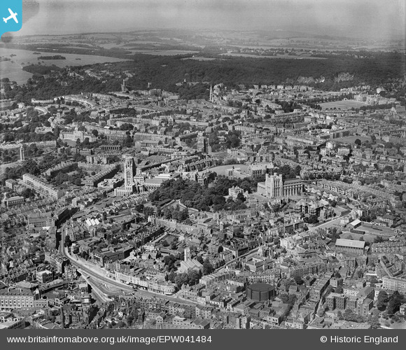
EPW041484 ENGLAND (1933). The University of Bristol and environs, Bristol, from the east, 1933
© Copyright OpenStreetMap contributors and licensed by the OpenStreetMap Foundation. 2026. Cartography is licensed as CC BY-SA.
Nearby Images (9)
EPW041484

EAW015782

EAW015781

EAW015784

EAW015779

EPW047092

EAW015780

EAW015783

EPW047091

Details
| Title | [EPW041484] The University of Bristol and environs, Bristol, from the east, 1933 |
| Reference | EPW041484 |
| Date | June-1933 |
| Link | |
| Place name | BRISTOL |
| Parish | |
| District | |
| Country | ENGLAND |
| Easting / Northing | 358399, 173297 |
| Longitude / Latitude | -2.5988198250167, 51.456633049572 |
| National Grid Reference | ST584733 |
Pins

Russell |
Monday 11th of May 2015 05:54:56 PM | |
|
Russell |
Monday 11th of May 2015 05:54:20 PM | |
|
Russell |
Monday 11th of May 2015 05:53:44 PM | |
|
Russell |
Monday 11th of May 2015 05:52:13 PM | |
|
StevePalmer1947 |
Saturday 27th of July 2013 07:26:36 PM | |

Class31 |
Monday 24th of June 2013 04:58:20 PM | |
|
Louis |
Tuesday 7th of May 2013 08:09:01 PM | |
|
Louis |
Tuesday 7th of May 2013 08:05:05 PM |