
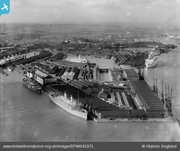
EPW041071 ENGLAND (1933). The docks, Southampton, from the south, 1933
© Copyright OpenStreetMap contributors and licensed by the OpenStreetMap Foundation. 2026. Cartography is licensed as CC BY-SA.
Nearby Images (22)
EPW041071

EPW009067

EPW009064

EAW033432

EPW037412

EPW039724

EAW033414

EAW001345

EAW033409

EAW035242

EAW033430

EPW037411

EAW033411

EPW020456

EPW009068

EAW033431

EAW051596

EAW033408

EAW051595

EPW037410

EAW001348

EPW037407

Details
| Title | [EPW041071] The docks, Southampton, from the south, 1933 |
| Reference | EPW041071 |
| Date | April-1933 |
| Link | |
| Place name | SOUTHAMPTON |
| Parish | |
| District | |
| Country | ENGLAND |
| Easting / Northing | 442627, 109772 |
| Longitude / Latitude | -1.3939470781598, 50.885307909398 |
| National Grid Reference | SU426098 |
Pins

Isleworth1961 |
Monday 10th of June 2013 08:29:12 PM | |
|
Isleworth1961 |
Saturday 25th of May 2013 12:43:18 AM |