
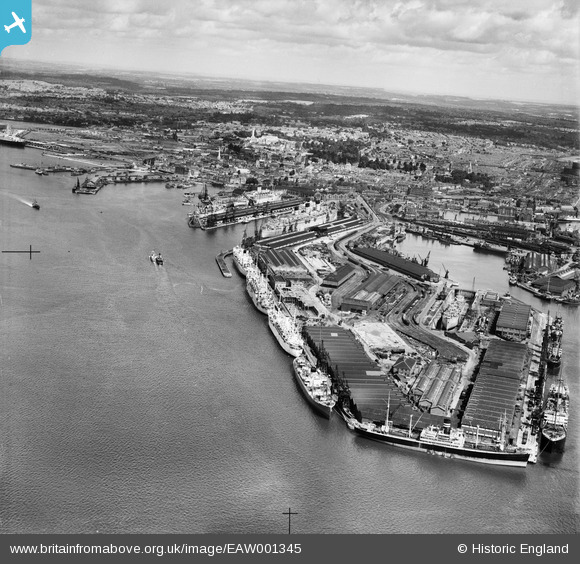
EAW001345 ENGLAND (1946). The Docks, Southampton, from the south, 1946
© Copyright OpenStreetMap contributors and licensed by the OpenStreetMap Foundation. 2026. Cartography is licensed as CC BY-SA.
Nearby Images (20)
EAW001345

EAW033411

EPW009064

EPW009067

EAW033432

EPW032346

EPW041071

EPW037412

EAW008809

EPW039724

EAW033414

EPW037407

EAW001348

EAW001349

EAW001369
 in Ocean Dock, Southampton, 1946")
EPW037411

EPW020456

EAW035242

EAW033409

EAW033430

Details
| Title | [EAW001345] The Docks, Southampton, from the south, 1946 |
| Reference | EAW001345 |
| Date | 28-June-1946 |
| Link | |
| Place name | SOUTHAMPTON |
| Parish | |
| District | |
| Country | ENGLAND |
| Easting / Northing | 442499, 109821 |
| Longitude / Latitude | -1.3957611202159, 50.885757997328 |
| National Grid Reference | SU425098 |
Pins

User Comment Contributions
Southampton Docks 01/05/2014 |

Class31 |
Friday 2nd of May 2014 03:53:17 PM |