
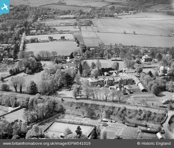
EPW041019 ENGLAND (1933). Winton House School and environs, Winchester, 1933
© Copyright OpenStreetMap contributors and licensed by the OpenStreetMap Foundation. 2025. Cartography is licensed as CC BY-SA.
Nearby Images (7)
EPW041019

EPW041020

EPW041014

EPW041016

EPW041018

EPW041017

EPW041015

Details
| Title | [EPW041019] Winton House School and environs, Winchester, 1933 |
| Reference | EPW041019 |
| Date | April-1933 |
| Link | |
| Place name | WINCHESTER |
| Parish | |
| District | |
| Country | ENGLAND |
| Easting / Northing | 447737, 130712 |
| Longitude / Latitude | -1.3185494986253, 51.073214760891 |
| National Grid Reference | SU477307 |
