
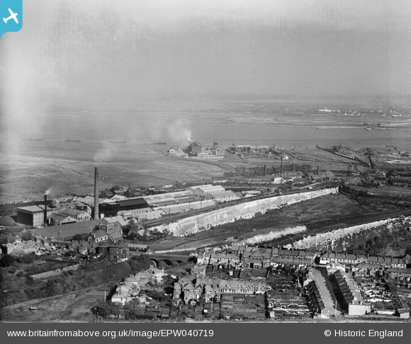
EPW040719 ENGLAND (1932). The High Street and factories beside Galley Hill Road, Swanscombe, from the south-west, 1932
© Copyright OpenStreetMap contributors and licensed by the OpenStreetMap Foundation. 2026. Cartography is licensed as CC BY-SA.
Nearby Images (17)
EPW040719

EPW028501

EPW040722

EPW040950

EPW018632

EPW040718

EPW040723

EPW028504

EPW028505

EPW040731

EAW050793

EAW050802

EPW028502

EAW050799

EAW050798

EAW050801

EPW040947

Details
| Title | [EPW040719] The High Street and factories beside Galley Hill Road, Swanscombe, from the south-west, 1932 |
| Reference | EPW040719 |
| Date | October-1932 |
| Link | |
| Place name | SWANSCOMBE |
| Parish | SWANSCOMBE AND GREENHITHE |
| District | |
| Country | ENGLAND |
| Easting / Northing | 560572, 174733 |
| Longitude / Latitude | 0.31104045067518, 51.448295825294 |
| National Grid Reference | TQ606747 |
Pins
Be the first to add a comment to this image!