
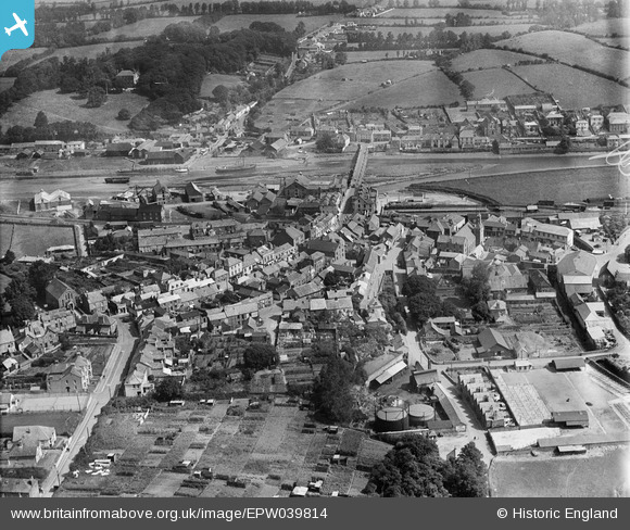
EPW039814 ENGLAND (1932). Molesworth Street, the Cattle Market and the town alongside the River Camel, Wadebridge, 1932
© Copyright OpenStreetMap contributors and licensed by the OpenStreetMap Foundation. 2026. Cartography is licensed as CC BY-SA.
Nearby Images (6)
EPW039814

EPW039812

EPW033052

EPW039813

EPW033049

EPW039815

Details
| Title | [EPW039814] Molesworth Street, the Cattle Market and the town alongside the River Camel, Wadebridge, 1932 |
| Reference | EPW039814 |
| Date | August-1932 |
| Link | |
| Place name | WADEBRIDGE |
| Parish | WADEBRIDGE |
| District | |
| Country | ENGLAND |
| Easting / Northing | 198940, 72344 |
| Longitude / Latitude | -4.8364160093521, 50.515705450218 |
| National Grid Reference | SW989723 |
Pins

ronS |
Saturday 24th of August 2013 02:27:08 AM |