
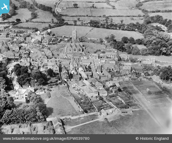
EPW039780 ENGLAND (1932). St Columba's Church and the town centre, St Columb Major, 1932
© Copyright OpenStreetMap contributors and licensed by the OpenStreetMap Foundation. 2026. Cartography is licensed as CC BY-SA.
Nearby Images (4)
EPW039780

EPW033086

EPW039779

EPW033087

Details
| Title | [EPW039780] St Columba's Church and the town centre, St Columb Major, 1932 |
| Reference | EPW039780 |
| Date | August-1932 |
| Link | |
| Place name | ST COLUMB MAJOR |
| Parish | ST. COLUMB MAJOR |
| District | |
| Country | ENGLAND |
| Easting / Northing | 191372, 63675 |
| Longitude / Latitude | -4.9381982652022, 50.435190080636 |
| National Grid Reference | SW914637 |
Pins

Lesley |
Wednesday 21st of June 2023 06:41:08 PM |