
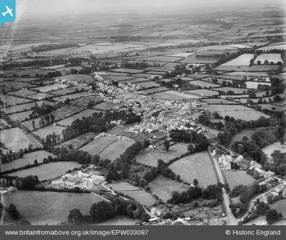
EPW033087 ENGLAND (1930). The town and surrounding countryside, St Columb Major, from the north-east, 1930
© Copyright OpenStreetMap contributors and licensed by the OpenStreetMap Foundation. 2026. Cartography is licensed as CC BY-SA.
Nearby Images (4)
EPW033087

EPW039780

EPW039779

EPW033086

Details
| Title | [EPW033087] The town and surrounding countryside, St Columb Major, from the north-east, 1930 |
| Reference | EPW033087 |
| Date | July-1930 |
| Link | |
| Place name | ST COLUMB MAJOR |
| Parish | ST. COLUMB MAJOR |
| District | |
| Country | ENGLAND |
| Easting / Northing | 191549, 63780 |
| Longitude / Latitude | -4.9357673605516, 50.43619610645 |
| National Grid Reference | SW915638 |
Pins
Be the first to add a comment to this image!