
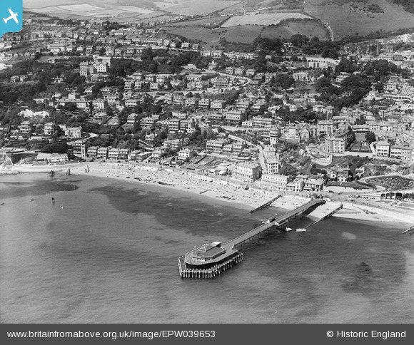
EPW039653 ENGLAND (1932). The Royal Victoria Pier and the town, Ventnor, 1932
© Copyright OpenStreetMap contributors and licensed by the OpenStreetMap Foundation. 2026. Cartography is licensed as CC BY-SA.
Nearby Images (26)
EPW039653

EPW022977

EPW022979

EAW015242

EPW043013

EPW023098

EPW032288

EAW038592

EPW043010

EPW039654

EPW043014

EPW032286

EPW022982

EAW038594

EPW039656

EAW022209

EAW015243

EPW023099

EPW032285

EAW022207

EPW022987

EPW023097

EPW023096

EAW022210

EAW022208

EPW022978

Details
| Title | [EPW039653] The Royal Victoria Pier and the town, Ventnor, 1932 |
| Reference | EPW039653 |
| Date | 12-August-1932 |
| Link | |
| Place name | VENTNOR |
| Parish | VENTNOR |
| District | |
| Country | ENGLAND |
| Easting / Northing | 456146, 77390 |
| Longitude / Latitude | -1.2066923880685, 50.592946660195 |
| National Grid Reference | SZ561774 |
Pins

chaz |
Saturday 20th of June 2015 12:31:20 PM |