
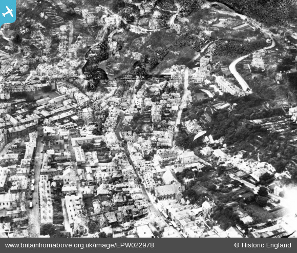
EPW022978 ENGLAND (1928). Grove Road and environs, Ventnor, 1928. This image has been produced from a damaged print.
© Copyright OpenStreetMap contributors and licensed by the OpenStreetMap Foundation. 2026. Cartography is licensed as CC BY-SA.
Nearby Images (9)
EPW022978

EPW022982

EPW032285

EPW043014

EAW038593

EPW032287

EPW032286

EAW015242

EPW039653

Details
| Title | [EPW022978] Grove Road and environs, Ventnor, 1928. This image has been produced from a damaged print. |
| Reference | EPW022978 |
| Date | August-1928 |
| Link | |
| Place name | VENTNOR |
| Parish | VENTNOR |
| District | |
| Country | ENGLAND |
| Easting / Northing | 456369, 77628 |
| Longitude / Latitude | -1.2035057432589, 50.59506550392 |
| National Grid Reference | SZ564776 |
Pins
Be the first to add a comment to this image!