
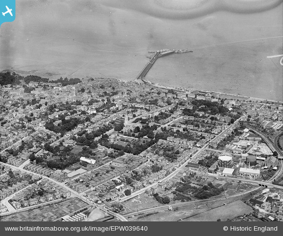
EPW039640 ENGLAND (1932). The town centre and the pier, Ryde, from the south-east, 1932
© Copyright OpenStreetMap contributors and licensed by the OpenStreetMap Foundation. 2026. Cartography is licensed as CC BY-SA.
Nearby Images (11)
EPW039640

EAW025806

EAW025807

EAW025804

EAW025805

EAW025802

EAW025803

EAW025801

EAW025808

EPW043018

EAW022221

Details
| Title | [EPW039640] The town centre and the pier, Ryde, from the south-east, 1932 |
| Reference | EPW039640 |
| Date | 12-August-1932 |
| Link | |
| Place name | RYDE |
| Parish | RYDE |
| District | |
| Country | ENGLAND |
| Easting / Northing | 459605, 92213 |
| Longitude / Latitude | -1.1554368490495, 50.725904290855 |
| National Grid Reference | SZ596922 |
Pins

John W |
Sunday 8th of January 2017 08:42:14 PM | |
|
Ann E 21 |
Saturday 29th of November 2014 12:38:52 AM | |

Class31 |
Tuesday 29th of October 2013 12:37:02 PM | |
|
MB |
Tuesday 19th of February 2013 08:42:19 AM | |
|
SteveAUS |
Tuesday 19th of February 2013 04:17:30 AM |

User Comment Contributions
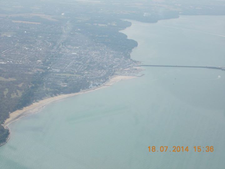
An aerial view of the town and pier, Ryde, 18/07/2014. Courtesy Con Shields |
Class31 |
Monday 12th of January 2015 12:28:47 PM |