
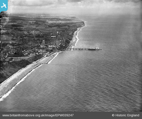
EPW039247 ENGLAND (1932). The pier and town, Cromer, from the east, 1932
© Copyright OpenStreetMap contributors and licensed by the OpenStreetMap Foundation. 2026. Cartography is licensed as CC BY-SA.
Nearby Images (3)
EPW039247

EAW051639

EAW051640

Details
| Title | [EPW039247] The pier and town, Cromer, from the east, 1932 |
| Reference | EPW039247 |
| Date | July-1932 |
| Link | |
| Place name | CROMER |
| Parish | CROMER |
| District | |
| Country | ENGLAND |
| Easting / Northing | 622387, 342193 |
| Longitude / Latitude | 1.3092746334842, 52.93068326594 |
| National Grid Reference | TG224422 |
Pins

John W |
Wednesday 22nd of March 2017 09:33:35 PM | |

Alan McFaden |
Sunday 14th of July 2013 10:49:43 AM | |
|
Alan McFaden |
Sunday 14th of July 2013 10:48:46 AM | |
|
Alan McFaden |
Sunday 14th of July 2013 10:47:32 AM | |
|
Alan McFaden |
Sunday 14th of July 2013 10:45:59 AM | |
|
Alan McFaden |
Sunday 14th of July 2013 10:42:49 AM | |
|
Alan McFaden |
Sunday 14th of July 2013 10:41:27 AM | |
|
Alan McFaden |
Sunday 14th of July 2013 10:40:33 AM |


