
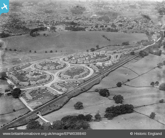
EPW038840 ENGLAND (1932). Housing estate to the east of Kendal Castle, Kendal, 1932
© Copyright OpenStreetMap contributors and licensed by the OpenStreetMap Foundation. 2025. Cartography is licensed as CC BY-SA.
Nearby Images (6)
EPW038840

EPW026757

EPW026758

EPW026546A

EPW038839

EPW026546

Details
| Title | [EPW038840] Housing estate to the east of Kendal Castle, Kendal, 1932 |
| Reference | EPW038840 |
| Date | July-1932 |
| Link | |
| Place name | KENDAL |
| Parish | KENDAL |
| District | |
| Country | ENGLAND |
| Easting / Northing | 352580, 492350 |
| Longitude / Latitude | -2.7291787900016, 54.324368395994 |
| National Grid Reference | SD526924 |
Pins

John Wass |
Sunday 1st of November 2015 07:55:47 PM |