
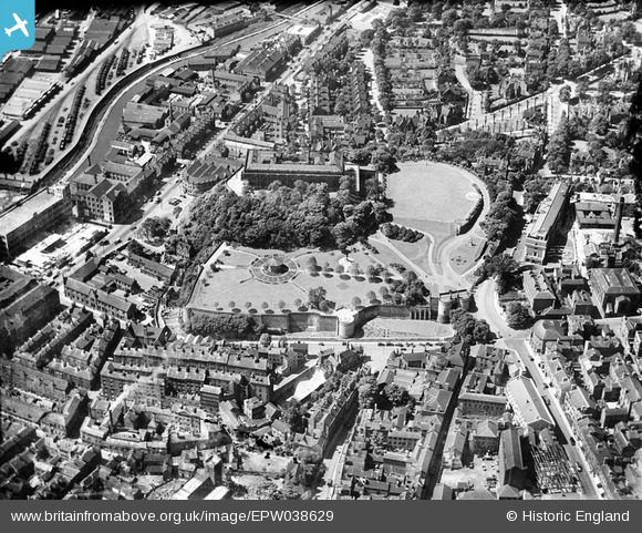
EPW038629 ENGLAND (1932). The Castle, Nottingham, 1932
© Copyright OpenStreetMap contributors and licensed by the OpenStreetMap Foundation. 2026. Cartography is licensed as CC BY-SA.
Nearby Images (26)
EPW038629

EAW006399

EAW006400

EAW006395

EAW006397

EPW038632

EAW006396

EPW012557

EAW042518

EAW050485

EPW054987

EAW006401

EAW044654

EAW006398

EPW013012

EAW021701

EAW025937

EPW050652

EPW019376

EAW009531

EPW038048

EAW050484

EPW038049

EPW038046

EPW045370

EPW038047

Details
| Title | [EPW038629] The Castle, Nottingham, 1932 |
| Reference | EPW038629 |
| Date | June-1932 |
| Link | |
| Place name | NOTTINGHAM |
| Parish | |
| District | |
| Country | ENGLAND |
| Easting / Northing | 456951, 339491 |
| Longitude / Latitude | -1.1522824177966, 52.949460391703 |
| National Grid Reference | SK570395 |
Pins
Be the first to add a comment to this image!