
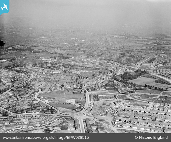
EPW038515 ENGLAND (1932). New housing estates off Thimblemill Road, Warley Road and the Uplands Cemetery, Smethwick, from the west, 1932
© Copyright OpenStreetMap contributors and licensed by the OpenStreetMap Foundation. 2025. Cartography is licensed as CC BY-SA.
Nearby Images (2)
EPW038515

EPW038512

Details
| Title | [EPW038515] New housing estates off Thimblemill Road, Warley Road and the Uplands Cemetery, Smethwick, from the west, 1932 |
| Reference | EPW038515 |
| Date | June-1932 |
| Link | |
| Place name | SMETHWICK |
| Parish | |
| District | |
| Country | ENGLAND |
| Easting / Northing | 400908, 287315 |
| Longitude / Latitude | -1.986627811066, 52.483386766658 |
| National Grid Reference | SP009873 |
Pins

Toby Bird |
Monday 7th of December 2015 09:54:28 PM | |
|
Steve Cemm |
Friday 4th of January 2013 06:15:45 PM |