
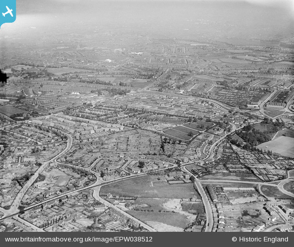
EPW038512 ENGLAND (1932). New housing estates off Warley Road, Thimblemill Road and the Uplands Cemetery, Smethwick, from the west, 1932
© Copyright OpenStreetMap contributors and licensed by the OpenStreetMap Foundation. 2025. Cartography is licensed as CC BY-SA.
Nearby Images (3)
EPW038512

EPW017032

EPW038515

Details
| Title | [EPW038512] New housing estates off Warley Road, Thimblemill Road and the Uplands Cemetery, Smethwick, from the west, 1932 |
| Reference | EPW038512 |
| Date | June-1932 |
| Link | |
| Place name | SMETHWICK |
| Parish | |
| District | |
| Country | ENGLAND |
| Easting / Northing | 401142, 287425 |
| Longitude / Latitude | -1.9831812972321, 52.484375337152 |
| National Grid Reference | SP011874 |
Pins

lee |
Wednesday 25th of January 2017 04:16:55 PM | |
|
lee |
Wednesday 25th of January 2017 04:16:17 PM | |
|
artscotak2 |
Tuesday 8th of January 2013 03:06:10 PM | |
Old Chapel Inn |
Phil Uttley |
Friday 26th of September 2014 03:49:37 PM |
The Old Chapel pub. Originally called "The Hand of Providence" when it was first built in 1732. |
Kevin |
Saturday 13th of August 2016 01:29:23 AM |
|
artscotak2 |
Tuesday 8th of January 2013 03:05:28 PM | |
Smethwick's first church. Built in 1732. |
Kevin |
Saturday 13th of August 2016 01:30:06 AM |
|
artscotak2 |
Tuesday 8th of January 2013 03:04:02 PM | |
|
artscotak2 |
Tuesday 8th of January 2013 03:01:50 PM |