
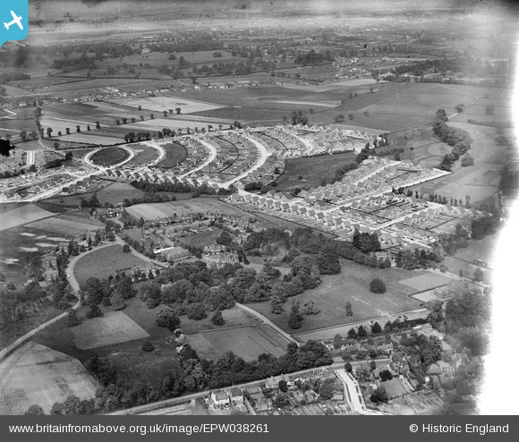
EPW038261 ENGLAND (1932). Greenwich Cottage Homes and new housing around Marlborough Park and environs, Sidcup, 1932
© Copyright OpenStreetMap contributors and licensed by the OpenStreetMap Foundation. 2026. Cartography is licensed as CC BY-SA.
Nearby Images (6)
EPW038261

EPW038257

EPW044393

EPW044396

EPW038258

EPW038259

Details
| Title | [EPW038261] Greenwich Cottage Homes and new housing around Marlborough Park and environs, Sidcup, 1932 |
| Reference | EPW038261 |
| Date | June-1932 |
| Link | |
| Place name | SIDCUP |
| Parish | |
| District | |
| Country | ENGLAND |
| Easting / Northing | 546209, 173453 |
| Longitude / Latitude | 0.10394859433438, 51.440684393101 |
| National Grid Reference | TQ462735 |
