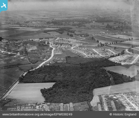
EPW038249 ENGLAND (1932). New housing around Christians Wood and environs, Blackfen, from the south-west, 1932
    © Copyright OpenStreetMap contributors and licensed by the OpenStreetMap Foundation. 2025. Cartography is licensed as CC BY-SA.
  
Nearby Images (5)
Details
| Title | [EPW038249] New housing around Christians Wood and environs, Blackfen, from the south-west, 1932 | 
| Reference | EPW038249 | 
| Date | July-1932 | 
| Link | |
| Place name | BLACKFEN | 
| Parish | |
| District | |
| Country | ENGLAND | 
| Easting / Northing | 545606, 173717 | 
| Longitude / Latitude | 0.095386283027871, 51.443212198751 | 
| National Grid Reference | TQ456737 | 
Pins
Be the first to add a comment to this image!
 
             
  ![[EPW038249] New housing around Christians Wood and environs, Blackfen, from the south-west, 1932](http://britainfromabove.org.uk/sites/all/libraries/aerofilms-images/public/100x100/EPW/038/EPW038249.jpg) 
  
                                          ![[EPW038247] New housing around Christians Wood and environs, Blackfen, from the south-west, 1932](http://britainfromabove.org.uk/sites/all/libraries/aerofilms-images/public/100x100/EPW/038/EPW038247.jpg) 
 ![[EPW038248] New housing around Christians Wood and environs, Blackfen, from the south-west, 1932](http://britainfromabove.org.uk/sites/all/libraries/aerofilms-images/public/100x100/EPW/038/EPW038248.jpg) 
 ![[EPW044280] Housing development around Woodlands Avenue and environs , Blackfen, 1934](http://britainfromabove.org.uk/sites/all/libraries/aerofilms-images/public/100x100/EPW/044/EPW044280.jpg) 
 ![[EPW038246] New housing around Christians Wood and environs, Blackfen, from the south-west, 1932](http://britainfromabove.org.uk/sites/all/libraries/aerofilms-images/public/100x100/EPW/038/EPW038246.jpg)